
World Machine To (Any) 3D Rendering Software
In all cases, your first step is to create your world. Consult all of the other learning resources for help in this.
Depending on your needs, this may include just a terrain, or also include ground cover texture. You can design and view your terrain completely from within World Machine.
To get the results into your application of choice, you have two options:
Heightmap based export
If your rendering application has support for heightmap or displacement maps, this is the best choice. It is usually far less memory and processor intensive than a mesh-based solution.
-
Setup Outputs
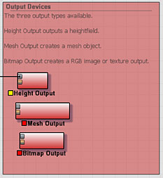
Place a Height Output device into your world. Wire the terrain you wish export into the device's input.
It's often also useful to export greyscale masks to guide texturing and other things as well. The Height Output is appropriate for this as well.
You can also export a colormap by placing a Bitmap Output and connecting it appropriately.
Select Export Format
Choose your export formats within the File Output device.
For heightmaps: most modern rendering programs will support 16bit TIFF or PNG formats. Check your application to see what it supports.
For bitmaps: BMP, TIFF, or PNG are all available.Build and Export
Build your world and export all files. The "Export Terrain files..." option from the File Menu provides a central location to do both.
Import
Import the heightfield into your application. Obviously this is very specific to the software you're using. You should consult your users manual or ask other users how they import heightmaps.
Mesh based export
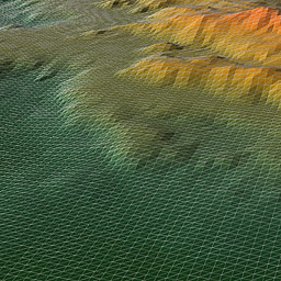
Using a mesh has one primary advantage over heightfields: Meshes are compatible with a huge range of available 3D software. Because of that, mesh export can be extremely useful. In addition, it is often easier to further edit, displace, or modify the geometry in your render application when you have a mesh than when using a terrain primitive.
-
Setup Outputs
Place a Mesh Output device into your world. Wire the terrain you wish export into the device's input.
It's often also useful to export greyscale masks to guide texturing and other things as well. The Height Output is appropriate for this.
You can also export a colormap by placing a Bitmap Output and connecting it appropriately.
Set Mesh Quality
Set the desired mesh density. The density is specified in kTriangles, so for example, a one million polygon mesh you would enter 1000. This allows you to create a smaller, manageable-sized geometry while still exporting full-resolution masks and textures.
Build and Export
Build your world and export all files. The "Export Terrain files..." option from the File Menu provides a central location to do both.
Import
Import the heightfield into your application. Obviously this is very specific to the software you're using. You should consult your users manual or ask other users how they import heightmaps.